Updating the Town of Dryden Comprehensive Plan
About
Home
About The Comprehensive Plan
Project Schedule
Steering Committee
The Glossary
Previous Planning Efforts
News & Project Updates
Calender of Events
Media
Project Updates
Meeting Minutes & Agendas
The Plan
Draft Materials
Community Mapping
Background Information
Community Engagement
Public Speaker Series
Community Survey Results
Virtual Workshop Overview
Virtual Workshop #1
Virtual Workshop #2
Virtual Workshop #3
Get Involved
Schedule a Presentation
Receive Updates
Attend a Meeting
Submit a Comment
Community Mapping
Community Mapping
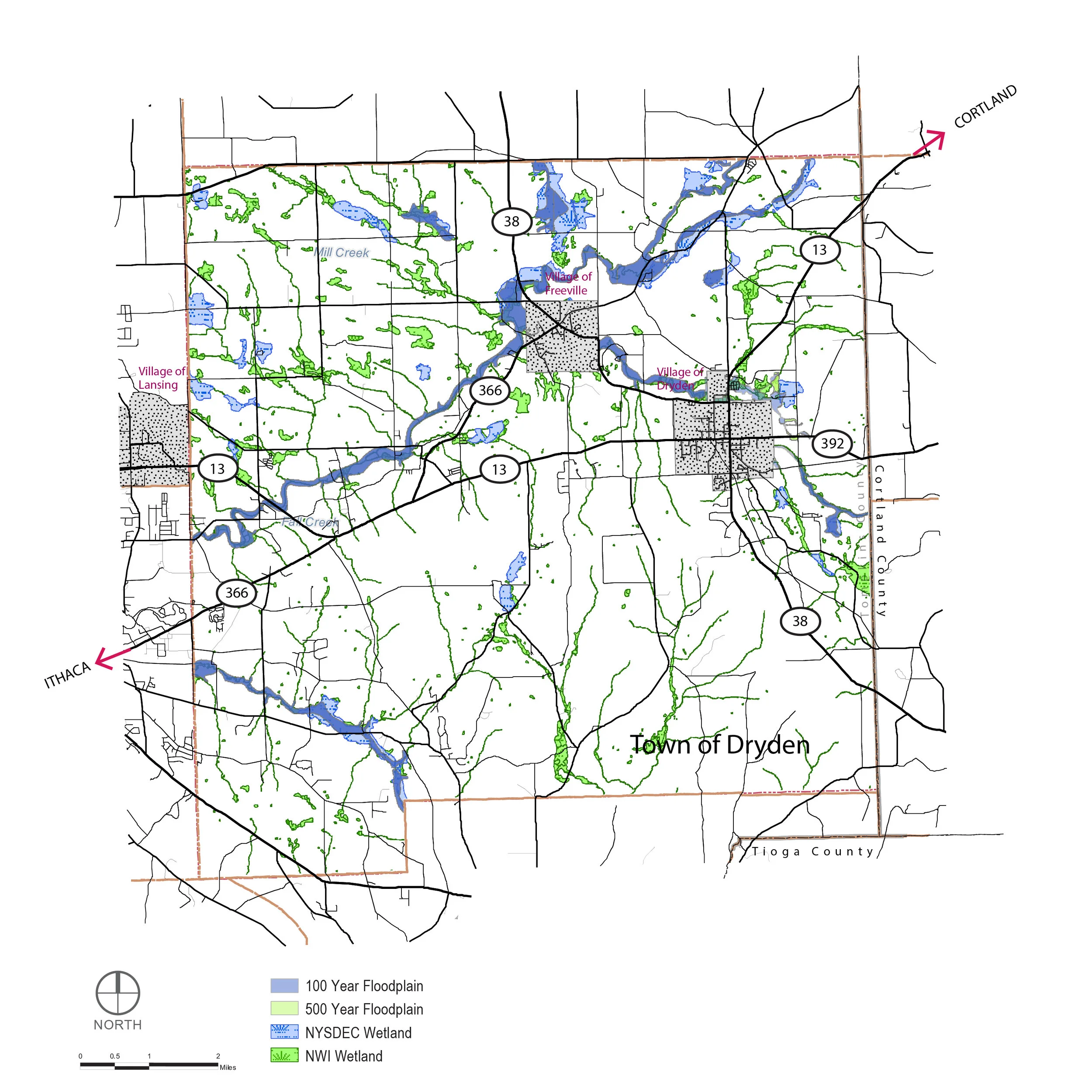
The following maps have been developed to support the update of the Town of Dryden Comprehensive Plan:
View fullsize
Regional Context
View fullsize
Trails
View fullsize
Protected Open Space
View fullsize
Bus Routes
View fullsize
Floodplains and Wetlands
View fullsize
Steep Slopes
View fullsize
Land Cover
View fullsize
Existing Land Use
View fullsize
Existing Zoning
View fullsize
Prime Farmland Areas
View fullsize
School Districts
View fullsize
Broadband Speed
View fullsize
Water and Sewer Infrastructure
View fullsize
Employment Density
View fullsize
Preferred Development Areas by Neighborhood
Content Link Block
Select a page and create a visual link to it.
Learn more
Community Mapping